


Partners in the Spotlight
Selected integrations
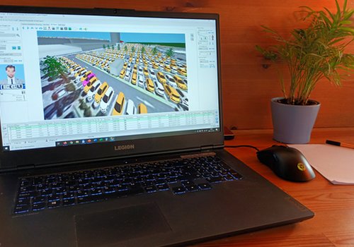
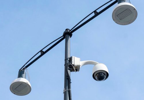
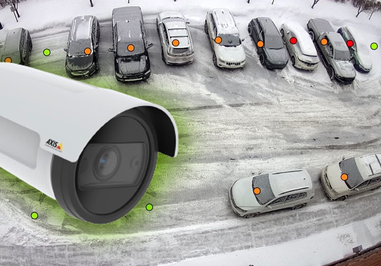
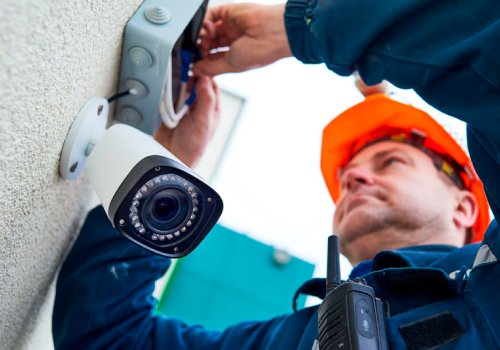
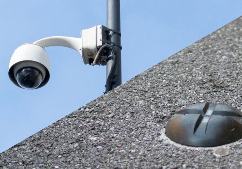
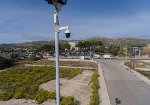
AXIS ACAP - Parquery in-camera
Fotokite - Parking & Traffic Surveys
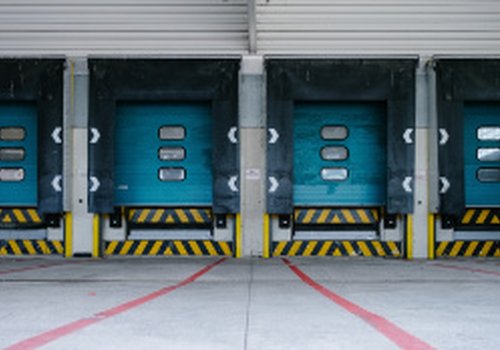
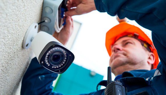
Parquery works with ANY camera


Selected integrations
AXIS ACAP - Parquery in-camera
Fotokite - Parking & Traffic Surveys
Parquery works with ANY camera
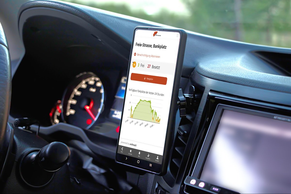
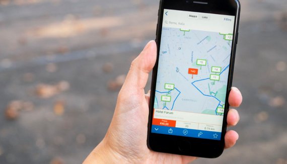
Get real-time parking, traffic, and pedestrian data in an instant. Test our technology, run a pilot project, or direct drivers with a mobile parking guidance system at an event. The possibilities are endless.
Parquery and Fotokite bring to you an innovative solution for parking management and traffic needs – tethered drones as instant mobile cameras. There is no need for costly and time-consuming equipment installation; instead, you get insights instantly.
Parquery's drone-based solution offers a quick, cost-effective alternative to conventional methods, particularly for temporary installations such as surveys, events, and pilot projects.
In partnership with the Swiss company Fotokite, we introduce tethered drones for parking and traffic solutions. No pilot needed for flying this drone.
Parquery's drone-based solution eliminates hurdles of conventional solutions, allowing you to:
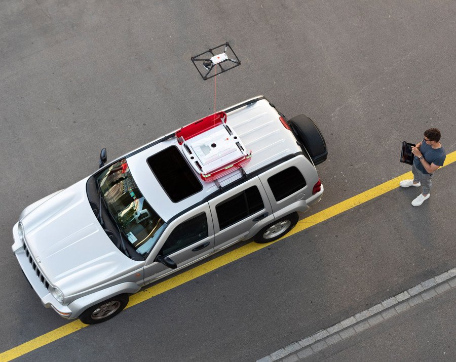
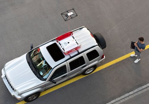
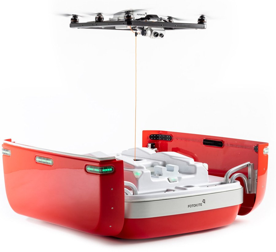
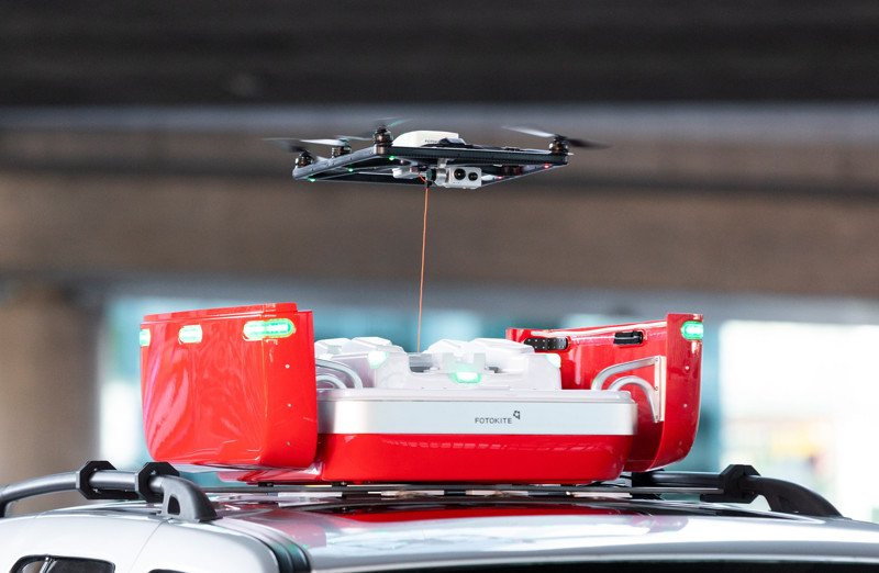
Fotokite flown from its rooftop box.
Built directly into the roof rack of vehicles, Fotokite provides the first practical daily-use tool for aerial intelligence.
(Photos © Fotokite)
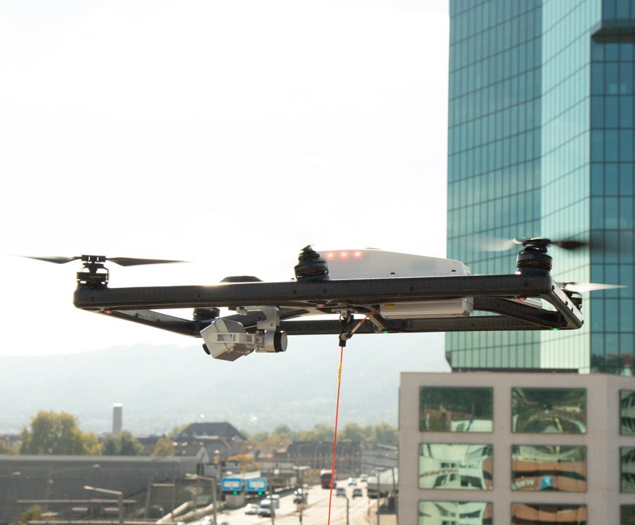
Fotokite's actively tethered drones save team resources by launching, flying, and landing with the single push of a button.
No piloting necessary.
Fotokite Sigma is authorized and recognized by aviation authorities as a safer alternative to non-actively tethered drones and free-flying drone systems.

Gain comprehensive data on parking utilization patterns without disrupting daily operations.
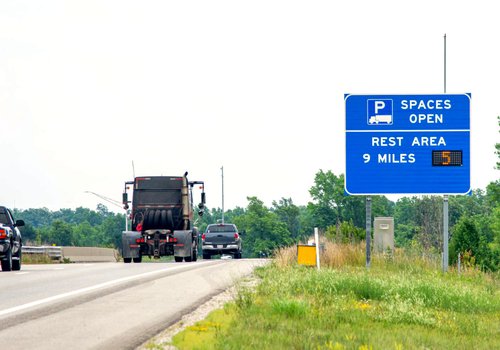
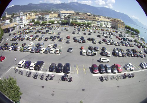
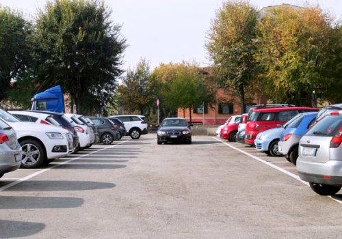
Conventional methods for parking surveys, such as manual counts, clicker counts, surveys or surveys via mobile app, are labor-intensive, prone to errors, partly depend on user participation, and can only be carried out at long intervals.
The result: incomplete data.
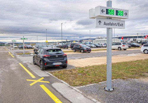
With a drone, such problems are history. Up to 300 parking spaces can be monitored in real time, providing reliable, complete and up-to-date data.

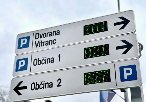
Streamline parking at events with live guidance, reducing congestion and frustration.
Typically, event parking relies on static signs and staff at critical locations connected over radio, requiring a lot of human resources and coordination.
With a drone, all parking attendants see the live availability in all areas, allowing them to make targeted routing decisions. In addition, mobile variable message signs (VMS) or LED road signs can be rented, connected to the Parquery system and used for effective guidance.

Try before you buy. Test our technology and parking management strategies with real-time data before making permanent changes.
Before investing in our solution or any other smart parking technology, such as in-ground sensors which might involve hardware purchases and road works, take advantage of our pilot projects to ensure compatibility and effectiveness.

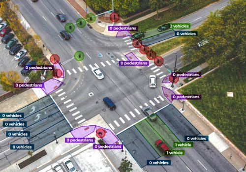
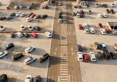
Measure traffic volume, speed, congestion patterns, vehicle types, incidents at intersections, highways, and urban areas.

Identification of potential safety risks through analysis of traffic events, behavior, incidents, near misses and accidents.

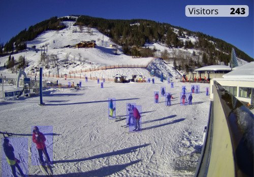
Understand pedestrian movement patterns in public spaces, shopping districts, and event venues.

Track traffic flow in or around construction zones to optimize traffic management and improve safety.
Fotokite flown from its rooftop box.
Built directly into the roof rack of vehicles, Fotokite provides the first practical daily-use tool for aerial intelligence.
(Photos © Fotokite)
At Parquery, we're committed to pushing the boundaries of what's possible in parking management and traffic flow analysis. Our tethered drone solutions bring cutting-edge technology to the forefront, providing our clients unparalleled efficiency, accuracy, and convenience.
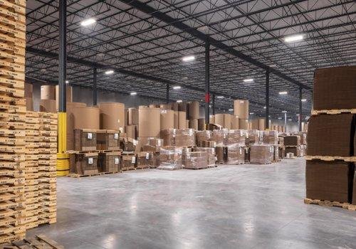
Parquery offers unique solutions for parking, traffic, logistics, and mobility - not only with drones, but with just about any camera.
We set ourselves apart from our competition with the abilities:
Our AI software analyzes the images and deletes them once processed.

We strictly comply with the European General Data Protection Regulation (GDPR) as well as the Swiss Federal Act on Data Protection (FADP). Our dedicated data protection page explains how and which options are available.

Parquery is an agile software development company. Bespoke solutions for our customers and partners are our daily bread.